Carson River Flood Aerial Views Spring 2023
Aerial Photography Flooding Views Carson City, NV
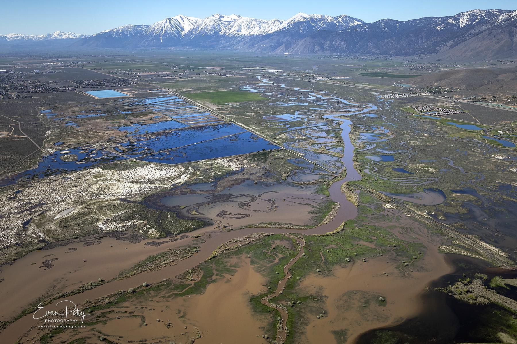
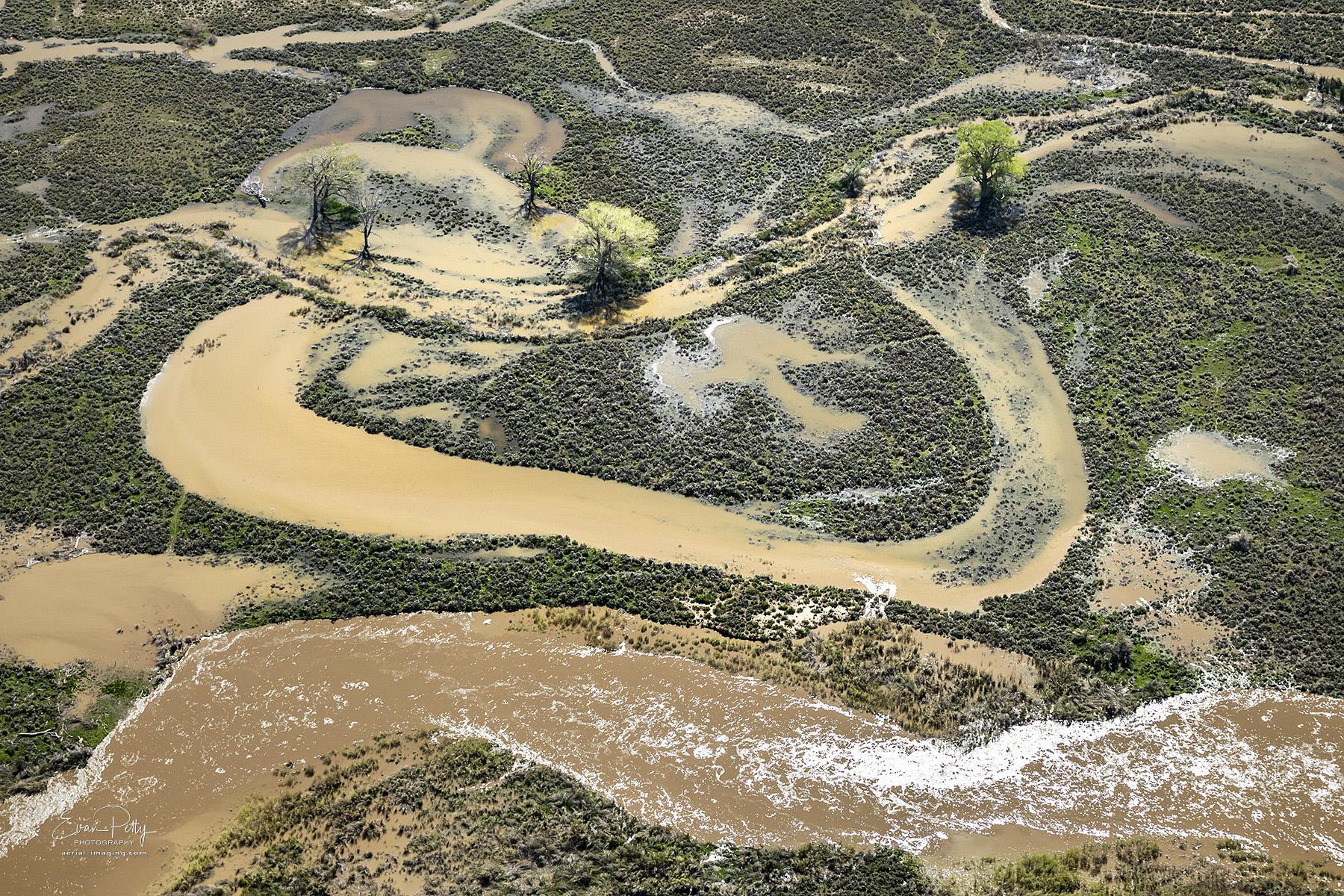
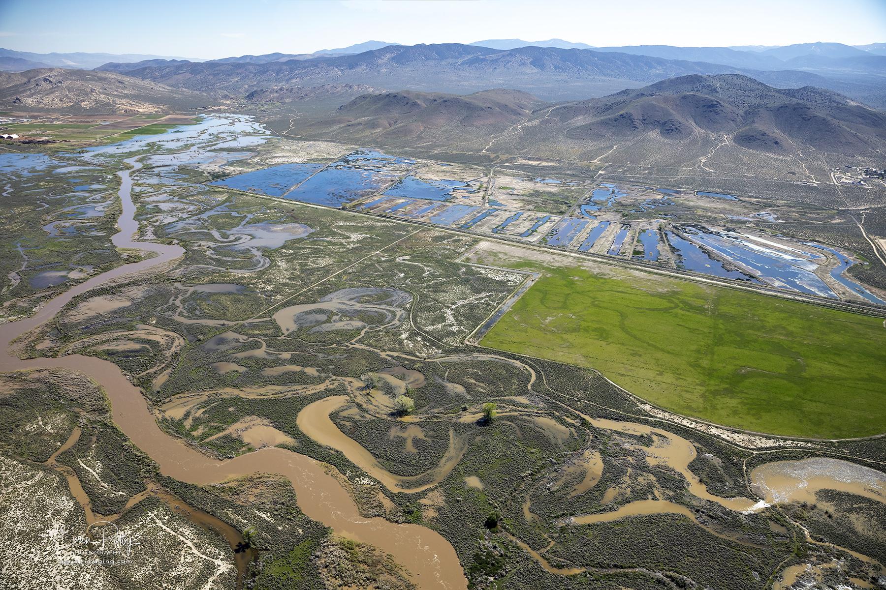
My recent aerial views of the flooded Carson River from Spring 2023. The snowmelt and recent rains have saturated this area of the Carson Valley. This view shows the river jumping its banks and filling the surrounding marsh areas. In the distance you can see the mountains east of Lake Tahoe near the amazing town of Genoa, NV.
This aerial view from this direction shows the northern part of the Bently-Kirman Ranch Trail System which follows the wetlands area for about 5 miles. This trail area is a destination for outdoor enthusiasts with its freshwater ecosystems and stunning natural beauty. Visitors can explore the wetland and diverse landscapes, including lush meadows, serene wetlands, and towering mountains in the distance.
The Bently-Kirman Tract offers a variety of trails suitable for all skill levels, from beginner hikers to experienced adventurers. Whether you prefer a leisurely stroll or a challenging hike, there is a trail that caters to your needs. Moreover, the trails are well-maintained, ensuring a safe and enjoyable experience for all visitors. Along the trails, you can engage in activities such as bird-watching, wildlife spotting, and photography. The tract is home to a diverse array of plant and animal species, making it an ideal spot for nature enthusiasts.